Friday 25 May 2012
Ray's tracking data
This is the data from Ray's GPS for each of the day's or routes that we took.
The times are hours:minutes:seconds, so note that some day's we were in the saddle for a long time, and day 16 is split into 4 parts.
Also look at the maximum speeds, these are in miles per hour, and I did not go that fast, it was just too scary!
Activities by swindonray
Activity Name ActivityStart Time Dist Ele + Avg Sp Max Sp Cals Pedals
LeJoG Day17 air Cycling Sat, 19 May 2012 7:10 AM 00:43:23 8.44 305 11.7 19 528 2,025.00
LeJoG Day16c Cycling Fri, 18 May 2012 4:00 PM 02:08:14 31.26 1,424 14.6 34.4 1,858 6,451.00
LeJoG Day16b Cycling Fri, 18 May 2012 1:23 PM 01:37:24 20.3 764 12.5 22.2 1,247 5,386.00
LeJoG Day16a Cycling Fri, 18 May 2012 8:08 AM 03:58:30 43.13 3,346 10.8 34.3 3,050 11,920.00
LeJoG Day15b Cycling Thu, 17 May 2012 3:10 PM 00:46:41 9.05 541 11.6 36.3 621 1,911.00
LeJoG Day15a Cycling Thu, 17 May 2012 9:41 AM 03:18:08 38.79 1,627 11.7 26.7 2,386 10,074.00
LeJoG Day14 Cycling Wed, 16 May 2012 8:22 AM 05:49:30 69.47 4,111 11.9 37.8 4,859 15,799.00
LeJoG Day13 Cycling Tue, 15 May 2012 9:29 AM 05:52:39 59.25 2,221 10.1 28.1 3,567 11,802.00
LeJoG Day 12 Cycling Mon, 14 May 2012 8:48 AM 07:11:34 94.46 4,731 13.1 33.6 6,631 21,792.00
LeJoG Day 11b Cycling Sun, 13 May 2012 4:27 PM 01:20:20 14.29 935 10.7 26.6 1,030 3,380.00
LeJoG Day11a Cycling Sun, 13 May 2012 7:48 AM 05:01:34 61.39 3,825 12.2 32.8 4,363 13,830.00
LeJoG Day10 Cycling Sat, 12 May 2012 9:14 AM 06:48:46 84.31 3,563 12.4 31.5 5,504 21,807.00
LeJoG Day9 Cycling Fri, 11 May 2012 8:50 AM 07:14:32 76.81 4,895 10.6 37.2 5,440 19,918.00
LeJoG Day8 Cycling Thu, 10 May 2012 8:35 AM 05:55:47 71.92 3,930 12.1 44.3 5,023 16,761.00
LeJoG Day7 Cycling Wed, 9 May 2012 9:22 AM 03:38:18 52.45 1,677 14.4 46 3,448 11,149.00
LeJoG Day6 Cycling Tue, 8 May 2012 9:20 AM 04:42:50 62.3 3,691 13.2 35 4,592 14,460.00
LeJoG Day5 Cycling Mon, 7 May 2012 10:45 AM 03:12:30 38.03 2,287 11.9 36 2,720 8,417.00
LeJoG Day4 Cycling Sun, 6 May 2012 8:23 AM 05:31:08 65.73 2,851 11.9 31.1 4,344 15,009.00
LeJog Day3 Cycling Sat, 5 May 2012 9:32 AM 04:42:42 48.97 3,953 10.4 38.5 3,604 12,680.00
LeJoG Day2 Cycling Fri, 4 May 2012 8:28 AM 07:00:49 71.61 6,969 10.2 35.8 5,736 17,020.00
LeJoG Day1 Cycling Thu, 3 May 2012 2:45 PM 02:02:24 25 1,591 12.3 37.1 1,423 5,779.00
LeJoG Day1 LE Cycling Thu, 3 May 2012 1:20 PM 00:59:05 11.92 1,050 12.1 32.6 801 2,725.00
Cheers
Paul
Sunday 20 May 2012
Final info and routes
Here are the actual routes that we took the data is taken from a Garmin GPS watch.
Day 1
Day 2
Day 3
Day 4
Day 5
Day 6
Day 7
Day 8
Day 9
Day 10
Day 11a
Day 11b
Day 12
Day 13
Day 14
Day 15
Day 16a
Day 16b
Day 16c
Day 16d
Train
To airport
The total distance was 1027 miles.
The equipment I had a GPS and an iPhone mounted on the bike. The GPS was used to provide details of routes, speed, travel time, etc. and the iPhone kept me in touch (signal permitted) to get text messages, and allowing for quick access to take photos. I also used the iPhone to try and make audio clips while on the bike, but they did not come out clearly due to too much background noise.
The weight difference between the kit that Ray and I took was significant, mine probably twice the weight of Ray's, my bike is also heavier.
Next time I would take less clothes, and to send on the heavy plastic mattress bag that I used to pack the bike in for the flight back.
Next time I would take a better pump so that we could pump up the tyres to a high pressure, without having to rely on bike shops.
One of the important parts of the trip was being able to stay dry and warm. If we put on waterproof tops and trousers early enough we could stay fairly dry. My waterproof trousers ended up roping as they kept getting caught on the chain or front gear changer, a way to tuck them in would have prevented this. The best method I found for keeping my feet dry was to wear thick socks, trainers waterproof overshoes then the water repellent tights over the top of that, so that the foot loop went under the trainers.
Staying safe on the road, was achieved by picking smaller roads whenever possible, letting lorries pass on twisty or narrow roads, and not undertaking. Even then there were a few incidents, so keeping aware of what is around is critical.
It was really great fun, and it did make me realise that the journey is what counts.
Cheers
Paul
Riding the length of the UK so you don't have to ;)
You can sponsor me at
https://www.justgiving.com/Margaret-beattie
Saturday 19 May 2012
Day 17 - The return
This morning's picture shows a cloudless and windless morning. Look at how bright it is this far north at 6am.
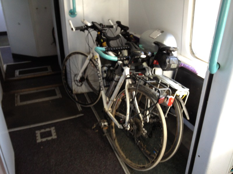
We have to catch the 8:40 train from Thurso, but we want to get there earlier so that nobody tries to take the only two bike spaces, that we have reserved. Apparently people turn up all the time expecting to be able to just put their bikes on the train. It is obviously silly that there are only two spaces, but it is clear on the website, it is just difficult to book.
We made it to the train in plenty of time despite a slow puncture on my front tyre. We were the only bikes getting on.
They mean it about the space available.
The train left 1 minute early!
It is a long twisty route to Inverness and we will be passing through many of the towns/villages that we cycled through. The first being Lairg, which we stayed in three nights ago.
I am recording the route on my GPS so you should be able to see how convoluted the route is.
The ride to the airport was, for a long way along the busy A9, then fortunately we took a back road to the airport.
We arrived in good time, and so we packed the bikes for the flight.


We were concerned on two counts, Ray had two pieces of hand luggage, and I had a pannier on the bike. However they said nothing about my pannier, just weighed in the bike at 21kg, and Ray held his bags together in one hand so that they looked like one.
The flight was uneventful, and fortunately Ray did not snore.
When we arrived in Bristol the bikes were the last luggage to come through.
The bikes were fine once we got them out of the plastic.
Our wives picked us up from the airport, and for me being in a car again seams really fast, and I flinch when we drive over drains or potholes.
Oh and apparently I need to shave the beard off!
Cheers
Paul
Riding the length of the UK so you don't have to ;)
You can sponsor me at
https://www.justgiving.com/Margaret-beattie
We have to catch the 8:40 train from Thurso, but we want to get there earlier so that nobody tries to take the only two bike spaces, that we have reserved. Apparently people turn up all the time expecting to be able to just put their bikes on the train. It is obviously silly that there are only two spaces, but it is clear on the website, it is just difficult to book.
We made it to the train in plenty of time despite a slow puncture on my front tyre. We were the only bikes getting on.
They mean it about the space available.
The train left 1 minute early!
It is a long twisty route to Inverness and we will be passing through many of the towns/villages that we cycled through. The first being Lairg, which we stayed in three nights ago.
I am recording the route on my GPS so you should be able to see how convoluted the route is.
The ride to the airport was, for a long way along the busy A9, then fortunately we took a back road to the airport.
We arrived in good time, and so we packed the bikes for the flight.
We were concerned on two counts, Ray had two pieces of hand luggage, and I had a pannier on the bike. However they said nothing about my pannier, just weighed in the bike at 21kg, and Ray held his bags together in one hand so that they looked like one.
The flight was uneventful, and fortunately Ray did not snore.
When we arrived in Bristol the bikes were the last luggage to come through.
The bikes were fine once we got them out of the plastic.
Our wives picked us up from the airport, and for me being in a car again seams really fast, and I flinch when we drive over drains or potholes.
Oh and apparently I need to shave the beard off!
Cheers
Paul
Riding the length of the UK so you don't have to ;)
You can sponsor me at
https://www.justgiving.com/Margaret-beattie
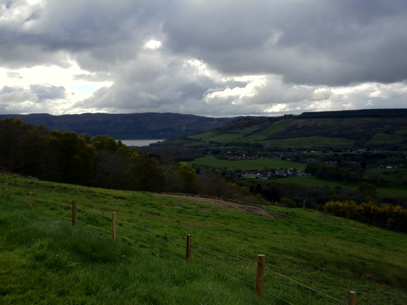
Friday 18 May 2012
Day 16 - The most, Westerly, Easterly and Northerly
Well our last day.
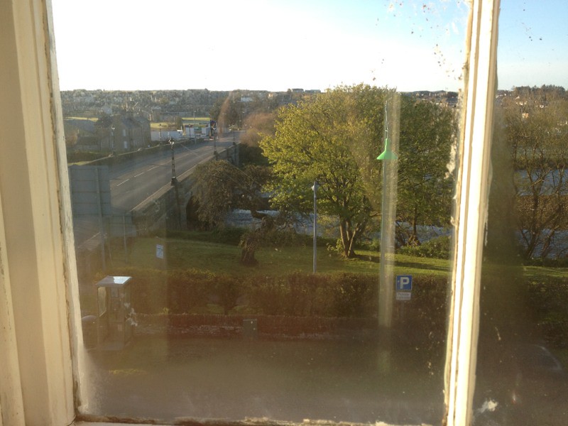
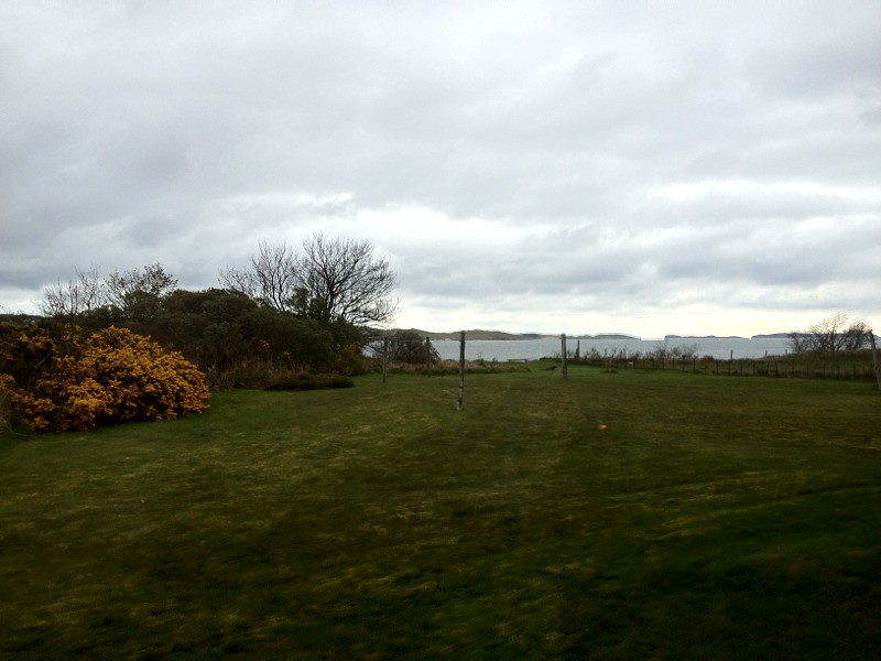
The view from the bedroom was this,
but the view from the kitchen was much more impressive.
We were up early this morning and on the road at around 8:00.
The road to Thurso was hillier than necessary. With long uphills, but also some fairly fast down hills. I went over a cattle grid at 26mph which is the fastest I've ever gone over one.
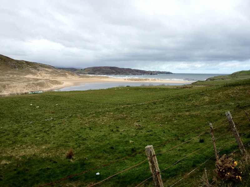
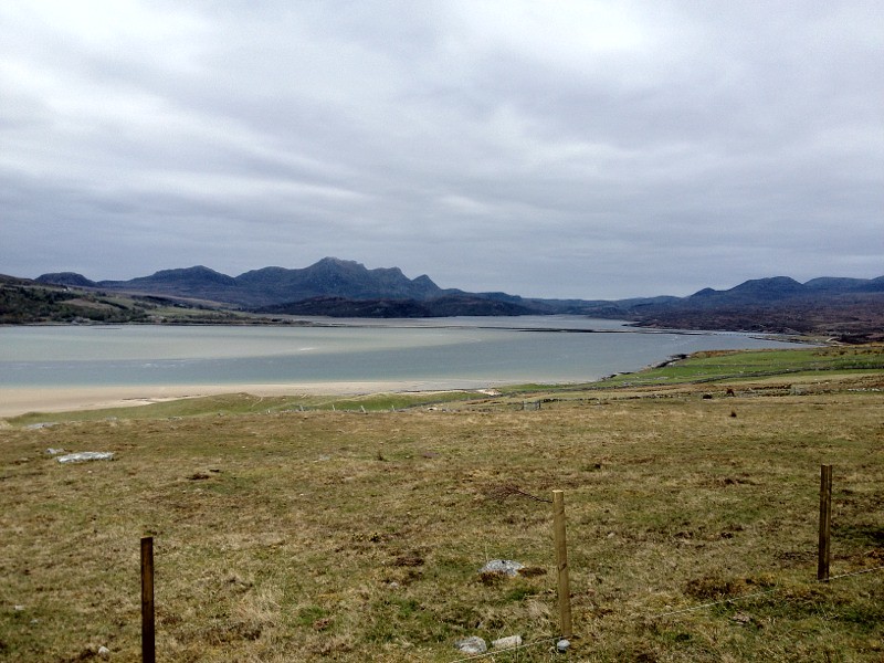
There were no really spectacular view but some interesting ones. Here is a sandy beach, which has something for everyone, except warm weather.
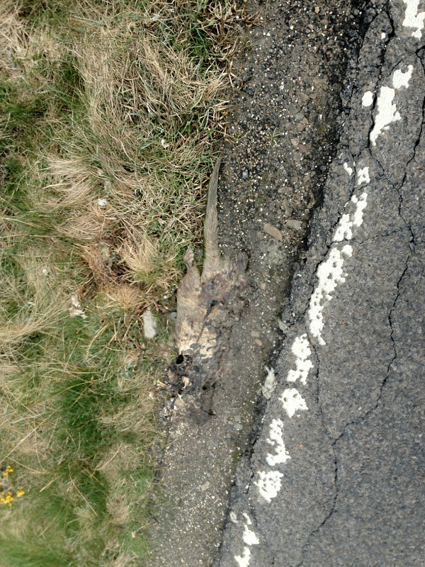
and The otters are so common here they are the local road kill ! (WARNING!!, you will also have to look sideways).
Having check last night that we could take our pedals off to get the bikes on the plane (yes we were worried about this). I obviously had not refitted my pedal correctly and it became more and more crooked until I had to check and found that I had damaged the thread in the pedal. So I retightened it as much as I could. The trouble was it was in the side with my good knee, so now I did not want to push with either leg, and my leg was being twisted due to the bent pedal as it went round.
We we're very pleased to see signs for John O'Groats, as it was starting to feel a long way. You may just be able to read the sign in this photo.
It was nice to keep seeing the sea as we went along the coast, but there were very few boats or harbours, until we got to ferry points, and then only 1 or 2 little ones.
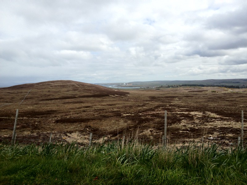
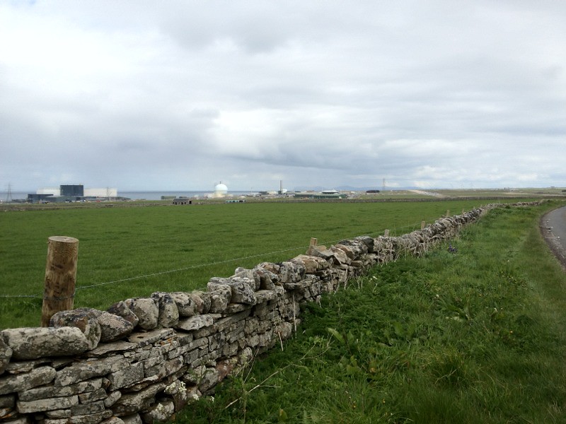
It was interesting to see the nuclear power station, and the wind turbines behind it (which you may or may not be able to see in this picture).
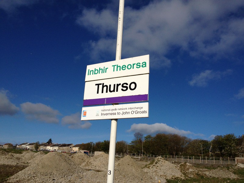
We arrived in Thurso at our digs at around 12:30, so we had made good time over the hilly 44 miles.

As you know, and as we had mentally prepared ourselves for, we were to drop off our (my) heavy bags before going on. However, clearly, otherwise I would not be saying we didn't. There was no response from the door nor the telephone. So with a bit of a knock we knew we were going to have to do another at least 44 miles with the panniers.
Before we left though we searched out a very helpful bike shop towards the northern end of Thurso. He managed to temporarily repair my pedal by retapping the threads and carefully refitting the pedal. Rather than me having to sponge off Ray ( remember I've lost my credit card) for a pair of new pedals and crank arm.
We then set off into a strong wind towards John O'Groats.
Ray set off as if after food, and I had to work hard to keep up. Then rather disheartenly I got a puncture in my front tyre, so I was now using my second repaired inner tube. I got a bit worried at this point about whether I would make it (as this is not TV, I will spare you the suspense and tell you that we did).
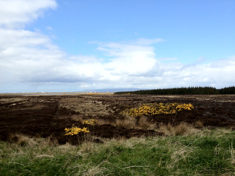
It was a long 22 miles through not especially interesting, but bleak countryside.
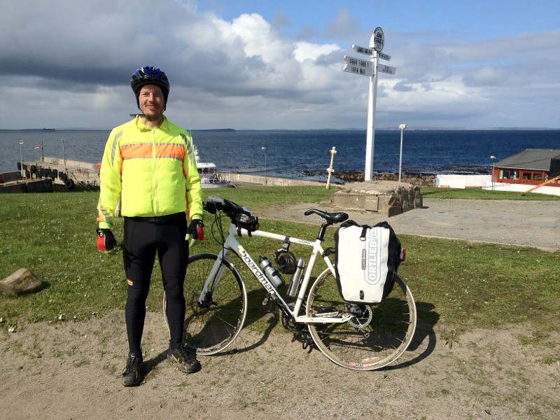
We then arrived at a developing John O'Groats. If you want to book a holiday home later in the summer here talk to the Scottish Tourist Board.
We took the obligatory photos of the first and last shop and "the sign", which was obviously wrong in our case as we did not take the shortest route.

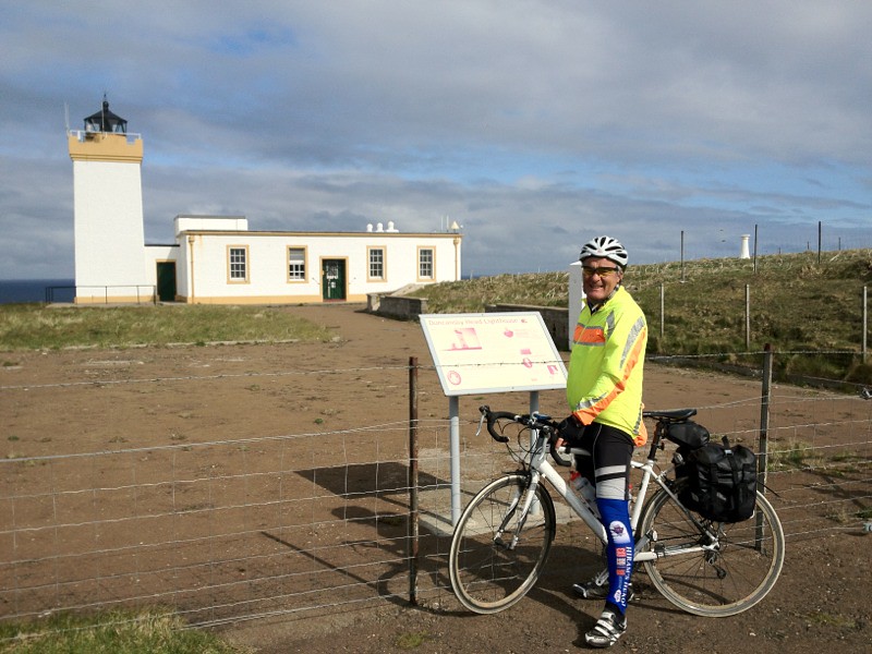
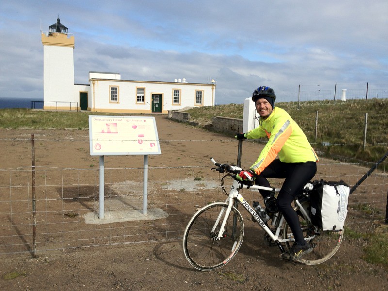
After looking around the shop, and having an Orkney ice scream, and not feeling overly satisfied, we went on to the lighthouse.
At the lighthouse we found a much more satisfactory sign saying that we had reach the most Easterly point in mainland UK.
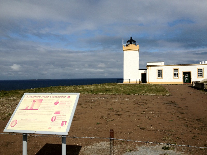
We now felt we had achieved something, however…
Not far away (relatively) is the most northerly point in mainland UK, at Dunnet Head which was only a 10 mile detour from our way back to Thurso.
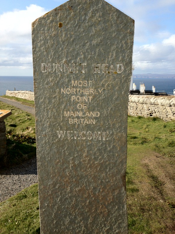
So now we really have achieved something.
We finally got back to our digs in Thurso at ten to seven, so it was a long day, and our second longest day travelling at about 95 miles.
After good showers we went out for a curry.
Thank you everyone for all your support, and encouragement it really did keep us going.
I will do a couple more posts during the weekend, about our journey back tomorrow, and giving details of the actual route we took, with comments about the good, bad and what I would do differently.
Thanks again for your support.
Cheers
Paul
Riding the length of the UK so you don't have to ;)
You can sponsor me at
https://www.justgiving.com/Margaret-beattie
The view from the bedroom was this,
but the view from the kitchen was much more impressive.
We were up early this morning and on the road at around 8:00.
The road to Thurso was hillier than necessary. With long uphills, but also some fairly fast down hills. I went over a cattle grid at 26mph which is the fastest I've ever gone over one.
There were no really spectacular view but some interesting ones. Here is a sandy beach, which has something for everyone, except warm weather.
and The otters are so common here they are the local road kill ! (WARNING!!, you will also have to look sideways).
Having check last night that we could take our pedals off to get the bikes on the plane (yes we were worried about this). I obviously had not refitted my pedal correctly and it became more and more crooked until I had to check and found that I had damaged the thread in the pedal. So I retightened it as much as I could. The trouble was it was in the side with my good knee, so now I did not want to push with either leg, and my leg was being twisted due to the bent pedal as it went round.
We we're very pleased to see signs for John O'Groats, as it was starting to feel a long way. You may just be able to read the sign in this photo.
It was nice to keep seeing the sea as we went along the coast, but there were very few boats or harbours, until we got to ferry points, and then only 1 or 2 little ones.
It was interesting to see the nuclear power station, and the wind turbines behind it (which you may or may not be able to see in this picture).
We arrived in Thurso at our digs at around 12:30, so we had made good time over the hilly 44 miles.
As you know, and as we had mentally prepared ourselves for, we were to drop off our (my) heavy bags before going on. However, clearly, otherwise I would not be saying we didn't. There was no response from the door nor the telephone. So with a bit of a knock we knew we were going to have to do another at least 44 miles with the panniers.
Before we left though we searched out a very helpful bike shop towards the northern end of Thurso. He managed to temporarily repair my pedal by retapping the threads and carefully refitting the pedal. Rather than me having to sponge off Ray ( remember I've lost my credit card) for a pair of new pedals and crank arm.
We then set off into a strong wind towards John O'Groats.
Ray set off as if after food, and I had to work hard to keep up. Then rather disheartenly I got a puncture in my front tyre, so I was now using my second repaired inner tube. I got a bit worried at this point about whether I would make it (as this is not TV, I will spare you the suspense and tell you that we did).
It was a long 22 miles through not especially interesting, but bleak countryside.
We then arrived at a developing John O'Groats. If you want to book a holiday home later in the summer here talk to the Scottish Tourist Board.
We took the obligatory photos of the first and last shop and "the sign", which was obviously wrong in our case as we did not take the shortest route.
After looking around the shop, and having an Orkney ice scream, and not feeling overly satisfied, we went on to the lighthouse.
At the lighthouse we found a much more satisfactory sign saying that we had reach the most Easterly point in mainland UK.
We now felt we had achieved something, however…
Not far away (relatively) is the most northerly point in mainland UK, at Dunnet Head which was only a 10 mile detour from our way back to Thurso.
So now we really have achieved something.
We finally got back to our digs in Thurso at ten to seven, so it was a long day, and our second longest day travelling at about 95 miles.
After good showers we went out for a curry.
Thank you everyone for all your support, and encouragement it really did keep us going.
I will do a couple more posts during the weekend, about our journey back tomorrow, and giving details of the actual route we took, with comments about the good, bad and what I would do differently.
Thanks again for your support.
Cheers
Paul
Riding the length of the UK so you don't have to ;)
You can sponsor me at
https://www.justgiving.com/Margaret-beattie
Thursday 17 May 2012
Day 15 - reached the top and had to stop
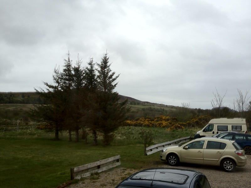
This morning's view is looking down the high street in Lairg towards the loch.
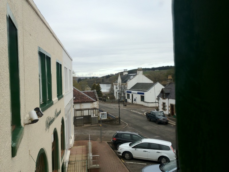
The chap on reception yesterday thought that we were with the Forestry, and there are four tree carrying lorries at the end of the road. The place is a bit drab and scruffy, but the people are nice.
Today should be a short 38 miles up to the northern edge of Scotland, from which we can only go left and right.
It was strange listening to traffic reports of hold ups in Earls Court road during breakfast. Even the Scottish weather reports only just commented on the weather where we are. Finally I think we are getting remote.
The route today though short and not particularly hilly had the most spectacular scenery of the whole trip.
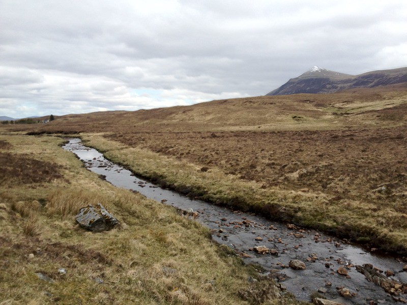
We travelled along the only road north from Lairg, the A836. This was 38 miles of single track road with passing places, through mountains and along the side of Loch Loyal.

We did see a family having a picnic on its beach, wearing wooly hats, gloves and coats.
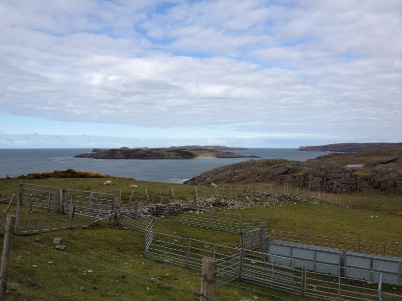
We were sure that we would see the sea round each corner, but it was not until we got right into tongue bay before we could see the sea breaking against the shallow sandy bay.

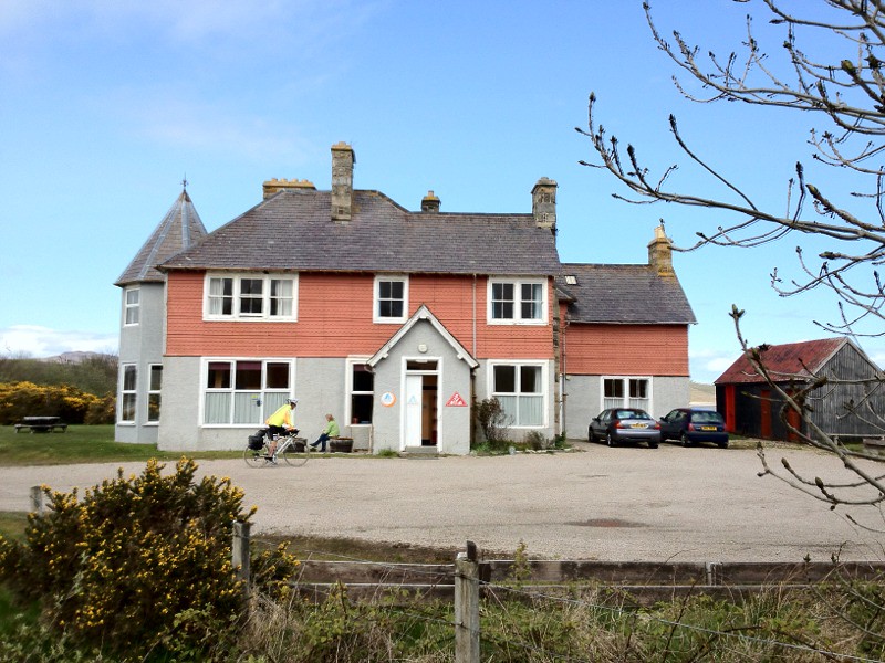
The youth hostel is nice, and the staff kindly let us into our room at 2:00, so that we could unload.
Having warmed up again, and having nothing else to do we set off for a cycle on the other side of the bay. There was a slight delay as I fixed a puncture. So I am now running on a repaired inner tube, so I'm hoping it lasts.
The other side of the bay gave good views looking back into the bay.
And out to sea, and Rabbit Island.
We then went back to the rather spare looking Spar shop with its single petrol pump, and bought food for dinner and breakfast.
Cheers
Paul
Riding the length of the UK so you don't have to ;)
You can sponsor me at
https://www.justgiving.com/Margaret-beattie
The chap on reception yesterday thought that we were with the Forestry, and there are four tree carrying lorries at the end of the road. The place is a bit drab and scruffy, but the people are nice.
Today should be a short 38 miles up to the northern edge of Scotland, from which we can only go left and right.
It was strange listening to traffic reports of hold ups in Earls Court road during breakfast. Even the Scottish weather reports only just commented on the weather where we are. Finally I think we are getting remote.
The route today though short and not particularly hilly had the most spectacular scenery of the whole trip.
We travelled along the only road north from Lairg, the A836. This was 38 miles of single track road with passing places, through mountains and along the side of Loch Loyal.
We did see a family having a picnic on its beach, wearing wooly hats, gloves and coats.
We were sure that we would see the sea round each corner, but it was not until we got right into tongue bay before we could see the sea breaking against the shallow sandy bay.
The youth hostel is nice, and the staff kindly let us into our room at 2:00, so that we could unload.
Having warmed up again, and having nothing else to do we set off for a cycle on the other side of the bay. There was a slight delay as I fixed a puncture. So I am now running on a repaired inner tube, so I'm hoping it lasts.
The other side of the bay gave good views looking back into the bay.
And out to sea, and Rabbit Island.
We then went back to the rather spare looking Spar shop with its single petrol pump, and bought food for dinner and breakfast.
Cheers
Paul
Riding the length of the UK so you don't have to ;)
You can sponsor me at
https://www.justgiving.com/Margaret-beattie
Day 14 - Happy birthday.
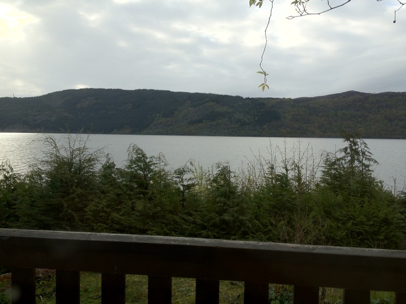
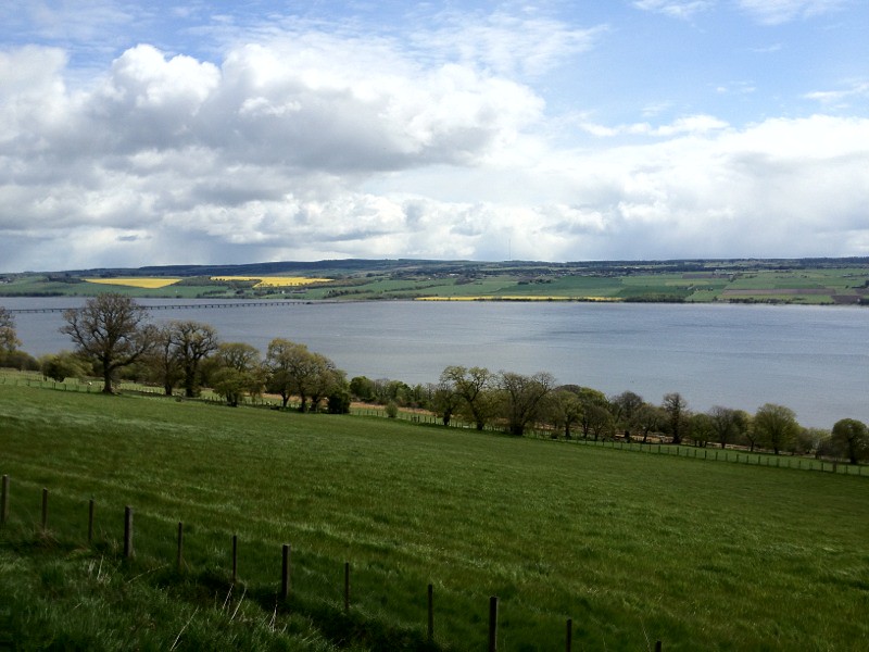
This morning's window view is of Loch Ness.
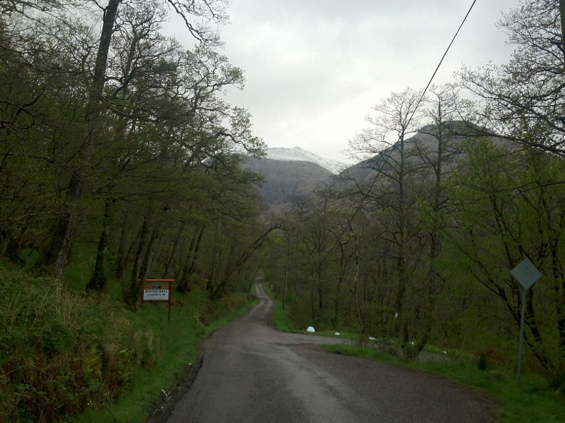
After a quick 10 miles along the busy A83(?), we headed on to quieter roads however Ray's shortcut was a little steep and we had to walk most of it, and even that was hard to do.
We got our last view of Loch Ness before we headed towards Beauly. I assume by now that you managed to see Nessy in the photos from yesterday, you do have to look hard.
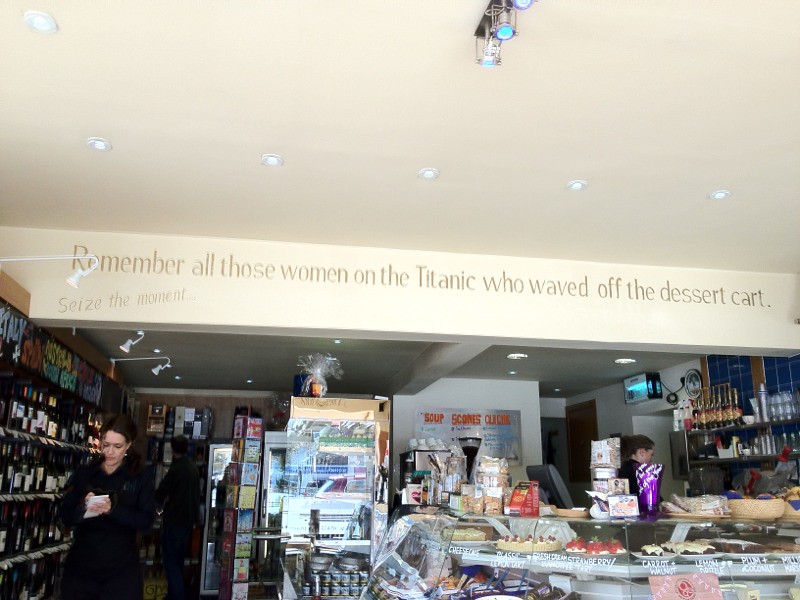
The deli in Beauly had an interesting sign, and an amazing range of things for sale considering it is a small town 10 miles north of Inverness.
Ray had a bacon roll with Stornaway black pudding, while I had Stornaway black pudding, Brie and Cranberry quiche (flan!).
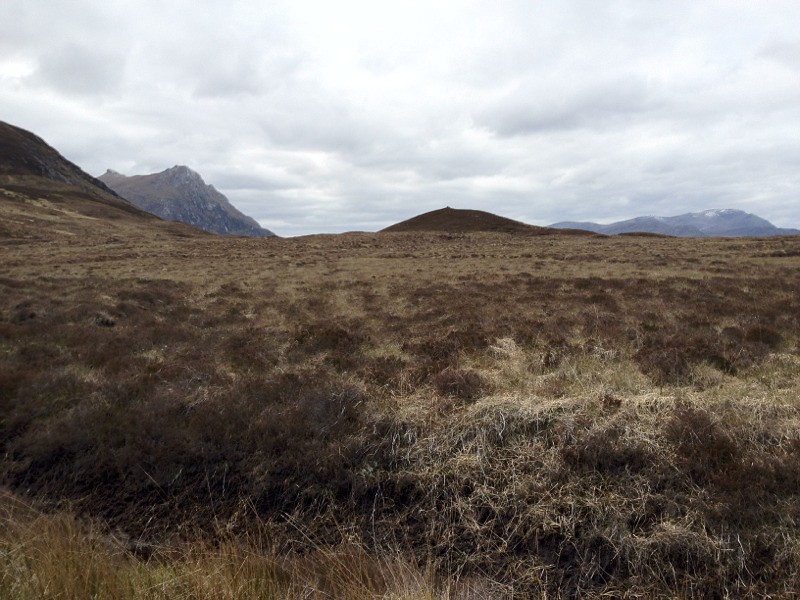
As always there were some fantastic views, as we travelled through some very remote areas.
We then crossed through the hills and saw out way ahead to Bonar Bridge and then on to Lairg.

When we were around just 4 miles from Lairg the road took us past Shin waterfall.

The falls were nice but the size of the visitor centre was extreme, and we have no idea how the narrow road was able to cope when it's busy.
So after 69.5 miles we arrived in Lairg at about 4:30 with only a slight shower, again the weather just reminding us that it was there, apart from that we are getting tanned faces and lower legs.
I have arranged dinner and a birthday cake for Ray but he does not know yet. It will be a surprise.
Ray opened the card that he was given by the Wanborough Vets, and has had a phone call from Bruce and from the crowd outside Fortnum and Mason, and others.

Cheers
Paul
Riding the length of the UK so you don't have to ;)
You can sponsor me at
https://www.justgiving.com/Margaret-beattie
After a quick 10 miles along the busy A83(?), we headed on to quieter roads however Ray's shortcut was a little steep and we had to walk most of it, and even that was hard to do.
We got our last view of Loch Ness before we headed towards Beauly. I assume by now that you managed to see Nessy in the photos from yesterday, you do have to look hard.
The deli in Beauly had an interesting sign, and an amazing range of things for sale considering it is a small town 10 miles north of Inverness.
Ray had a bacon roll with Stornaway black pudding, while I had Stornaway black pudding, Brie and Cranberry quiche (flan!).
As always there were some fantastic views, as we travelled through some very remote areas.
We then crossed through the hills and saw out way ahead to Bonar Bridge and then on to Lairg.
When we were around just 4 miles from Lairg the road took us past Shin waterfall.
The falls were nice but the size of the visitor centre was extreme, and we have no idea how the narrow road was able to cope when it's busy.
So after 69.5 miles we arrived in Lairg at about 4:30 with only a slight shower, again the weather just reminding us that it was there, apart from that we are getting tanned faces and lower legs.
I have arranged dinner and a birthday cake for Ray but he does not know yet. It will be a surprise.
Ray opened the card that he was given by the Wanborough Vets, and has had a phone call from Bruce and from the crowd outside Fortnum and Mason, and others.
Cheers
Paul
Riding the length of the UK so you don't have to ;)
You can sponsor me at
https://www.justgiving.com/Margaret-beattie
Tuesday 15 May 2012
Day 13 - perfect timing
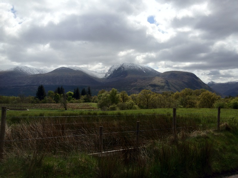
This mornings view is of the mountains in Glencoe.
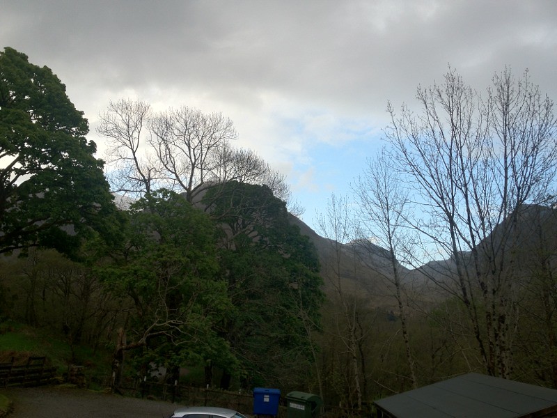
We made our own breakfast rather than the continental one that the hostal could have provided. Ours was much better, and everything was timed perfectly, with the toast popping up at the same time as microwave dinging and the scrambled egg being ready.
The views of the Glencoe mountains were magnificent, and beautifully topped with snow.
We then set off for Fort William along the narrow and busy A83. The big lorries and busses are very courteous, and we also pull over when we can to allow them past is the road is twisty and the can't see far enough ahead to overtake.
The problem we did have was with a caravan who drove so close that the caravan touches Ray's pannier straps. I thought it was close enough to me but it did not make contact.
We then arrived in a very dull looking Fort William, it does not look like a place worth visiting except for the beautiful Ben Nevis mountains.
We then went across the canal that links the lochs for boats, and just as we arrived the road and railway line were moved out of the way to let a boat through.

We then went along the north side of the Great Glen, starting on a small, then canal path.
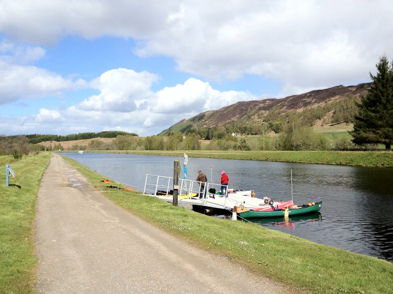
Which was flooded in places, the river is on the left and the canal is on the right, and this section sets the height limit for the canal.
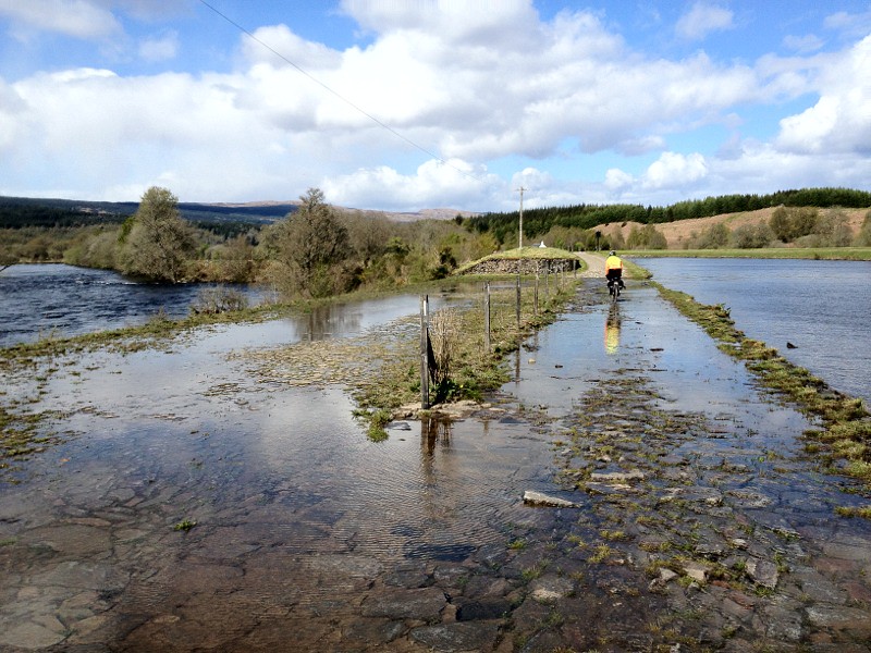
We then headed through woodland, but had to wait with a group of walkers, to be escorted through a section of woodland that was being felled. Four people got a ride in a vehicle, while the rest of us had to walk through a very muddy track. The woodland section took ages because it was too rough to cycle at any speed, and we are fearful of getting punctures.
We then had to rejoin the main road, and soon found a shop that was completely on its own selling loads of things. Including hit food, and a free view of the loch.
It was interesting to note that I think this is the part of the loch where the water flows out both ways. The locks on the canals flow different ways at the two ends.
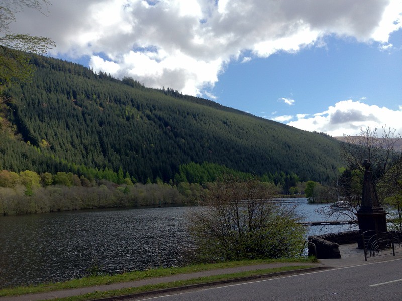
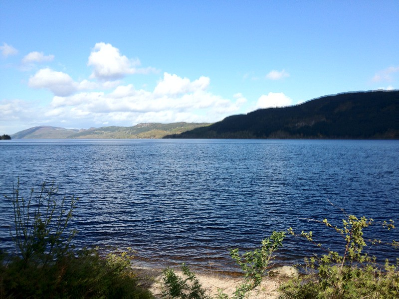
We are now at Loch Ness, which is stunning.
The hostel is a little more basic than the others we have had, but very good and friendly. We arrived 5 minutes before the hostel opened.
Dinner tonight was shepards pie that we were able to buy from the hostel.
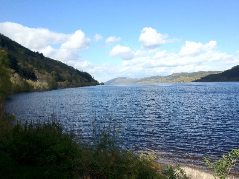
Finally can you see Nessy in this photo, it's a bit dark but if you look really closely.
Cheers
Paul
Riding the length of the UK so you don't have to ;)
You can sponsor me at
https://www.justgiving.com/Margaret-beattie
We made our own breakfast rather than the continental one that the hostal could have provided. Ours was much better, and everything was timed perfectly, with the toast popping up at the same time as microwave dinging and the scrambled egg being ready.
The views of the Glencoe mountains were magnificent, and beautifully topped with snow.
We then set off for Fort William along the narrow and busy A83. The big lorries and busses are very courteous, and we also pull over when we can to allow them past is the road is twisty and the can't see far enough ahead to overtake.
The problem we did have was with a caravan who drove so close that the caravan touches Ray's pannier straps. I thought it was close enough to me but it did not make contact.
We then arrived in a very dull looking Fort William, it does not look like a place worth visiting except for the beautiful Ben Nevis mountains.
We then went across the canal that links the lochs for boats, and just as we arrived the road and railway line were moved out of the way to let a boat through.
We then went along the north side of the Great Glen, starting on a small, then canal path.
Which was flooded in places, the river is on the left and the canal is on the right, and this section sets the height limit for the canal.
We then headed through woodland, but had to wait with a group of walkers, to be escorted through a section of woodland that was being felled. Four people got a ride in a vehicle, while the rest of us had to walk through a very muddy track. The woodland section took ages because it was too rough to cycle at any speed, and we are fearful of getting punctures.
We then had to rejoin the main road, and soon found a shop that was completely on its own selling loads of things. Including hit food, and a free view of the loch.
It was interesting to note that I think this is the part of the loch where the water flows out both ways. The locks on the canals flow different ways at the two ends.
We are now at Loch Ness, which is stunning.
The hostel is a little more basic than the others we have had, but very good and friendly. We arrived 5 minutes before the hostel opened.
Dinner tonight was shepards pie that we were able to buy from the hostel.
Finally can you see Nessy in this photo, it's a bit dark but if you look really closely.
Cheers
Paul
Riding the length of the UK so you don't have to ;)
You can sponsor me at
https://www.justgiving.com/Margaret-beattie
Subscribe to:
Posts (Atom)